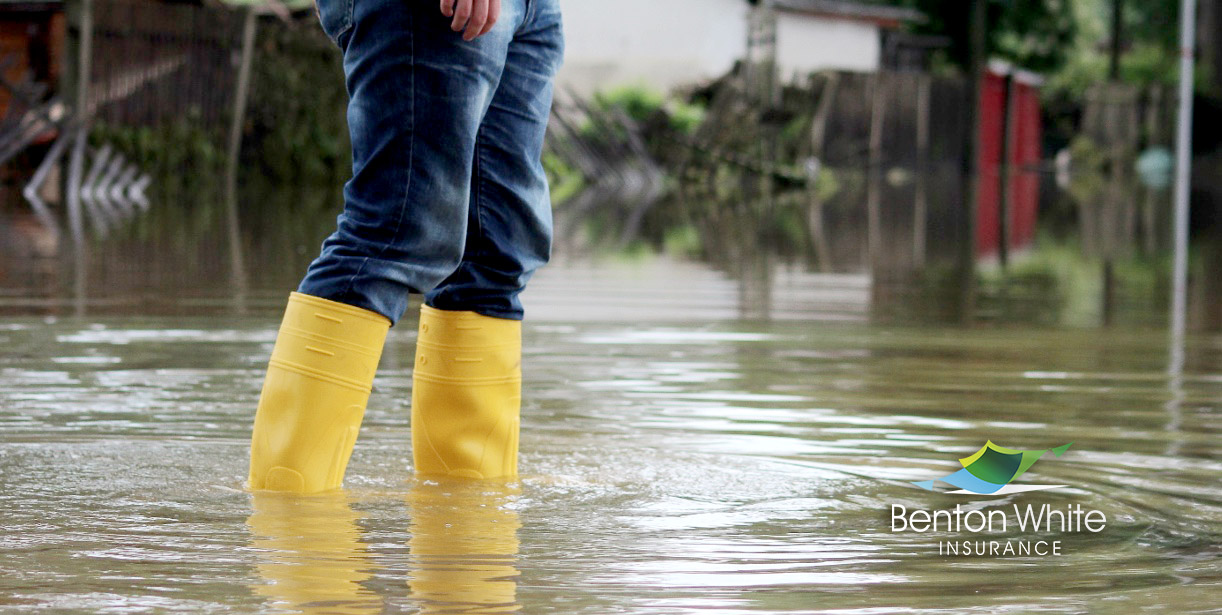
We will probably never forget – May 2010. We had more flood claims during that time than at any other time in our history. There were many sad parts of that event but one particular one for us here at the agency was that we had to say …” NOT COVERED!” That was something we never like to recite here. But many in our area never imagined the FLOODING we had during those few days and the devastation to property we saw. Because many of our customers did not have flood insurance, they heard unfortunately heard that phrase. There were other portions of home insurance coverage we were able to apply to help them. But the largest amount of damage for so many wasn’t covered.
Thousands of homeowners in the most flood-prone areas of Davidson County could see steep flood insurance rate hikes when the National Flood Insurance Program is overhauled this fall, data released by the First Street Foundation suggests.
Throughout the county, 12,736 homes at the greatest risk of structural damage from a one-in-100-year flood event could see flood insurance rates rise.
About 1,678 Nashville property owners in the 37214 zip code would need to pay $3,392 in premiums to cover the estimated costs of flood damage compared with the area’s current average NFIP premium of $545 — a 522.3% increase.
There also are 218 flood-prone homes in the 37064 zip code in the city of Franklin, which is primarily in Williamson County, but a small area of town is in Davidson County. Those home owners would need to pay an average premium of $4,567 to cover anticipated costs of flooding compared to the current average NFIP rate of $712, according to First Street’s data. That’s a 541.5% increase.
The majority of American homeowners won’t see massive rate changes, according to First Street’s data, and some may see their premiums decrease. Bordering Davidson County, some homes in La Vergne could see rates decrease about 66.8%, First Street’s calculations suggest.
“(As it stands), those that are at the very forefront of a flood zone, closest to the water, potentially have the same rate structure as those on the very edge of that flood zone, further inland,” said Forbes Tompkins, who manages the federal policy portfolio for Pew’s Flood-prepared Communities Initiative. “It tends to make sense that they probably shouldn’t be paying the exact same rate.”
More expensive properties and those with extreme flood risk are likely to see the biggest increases, which will be slowly phased in for existing policies at a maximum 18% increase per year. Rate reductions and higher rates for new policies would take effect immediately.
The NFIP is operated by the Federal Emergency Management Agency, which plans to launch its new “Risk Rating 2.0” in October. It’s the first time the program is expected to tie premiums to individual properties’ actual flood risks. FEMA has not said how it plans to calculate the new rates.
First Street, a Brooklyn-based research group, said it produced its risk estimates with modeling comparable to the approach FEMA would use.The model shows NFIP’s premiums are far below the cost of covering the actual risk for 4.26 million homes across the nation with “substantial risk” of structural damage from flooding, which is defined as a 1% annual chance of a major flood.
“Clearly, the premiums that are being collected versus the payments that are going out, there’s just not an equal balance there,” Tompkins said. Taxpayers are footing the bill for FEMA bailouts.
FEMA cautioned that First Street’s findings are only estimates and reflect only First Street’s opinion regarding what premiums should be, and do not have insight into the Risk Rating 2.0 initiative.
‘All areas of Nashville are at risk’ of flooding
Severe floods are more common in the Nashville area than residents might assume, said Sonia Allman, manager of communications for Metro Water Services.
The city is crisscrossed by a web of creeks and streams. In Allman’s view, “all areas of Nashville are at risk,” regardless of whether a property lies within a floodplain.
“You don’t have to live near a creek or stream to flood,” Allman said. “Every time we have a severe storm event where we have heavy rains and it rains extremely hard for a short period of time, that leads to isolated flooding.”
The Cumberland River surged to 12 feet above flood stage during a historic flood in May 2010 that damaged 10,900 structures in Davidson County. Only 3,908 of those property owners had flood insurance.
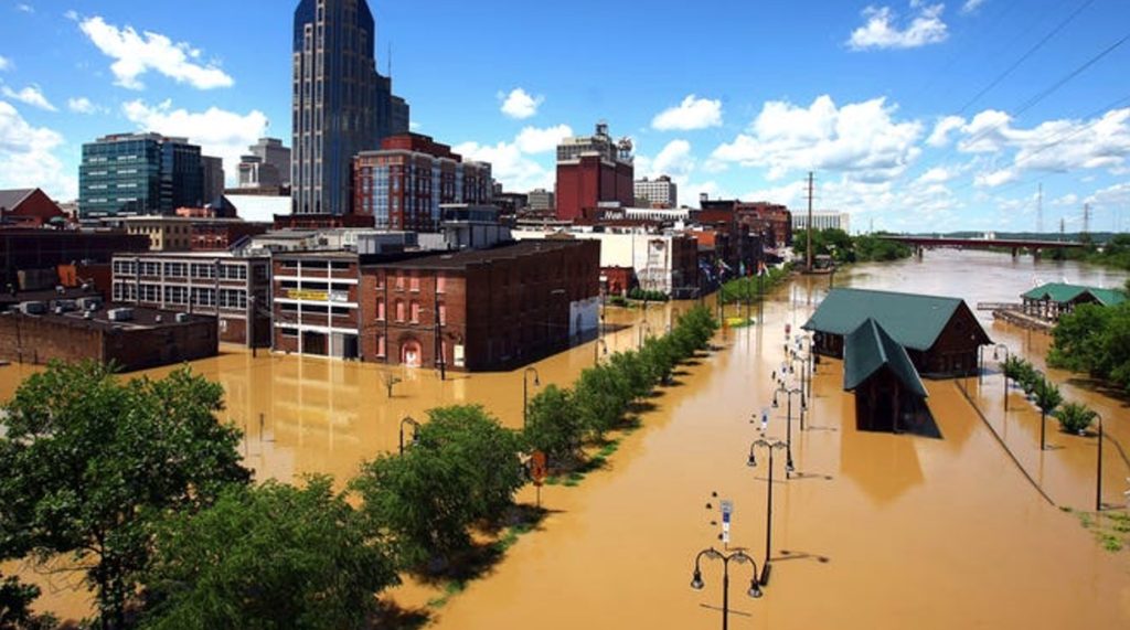
The disaster temporarily heightened public awareness of flood risks. The number of flood insurance policies in the county rose to about 7,000, according to Metro Water Services Assistant Director of Storm Water Tom Palko.
More than a decade later, that number has fallen to about 4,000, despite flood risks increasing, Palko said. Every property owner in the county — inside and outside of flood plains — can purchase flood insurance through the NFIP.
“It’s so important for property owners to know their flood risks, even if they don’t have a (federally-backed) mortgage and they’re not required to have flood insurance,” Allman said.
The Madison area experienced a flood in 2013 that was more severe than the 2010 flood, Allman noted.
More than 14% of Davidson County falls within special hazard flood zones, floodplains or floodways. Between 1996 and 2018, the Nashville Basin recorded 529 extreme weather events involving water, including floods, tropical depressions, heavy rain and tropical storms.
The idea of a one-in-100-year flood is commonly misunderstood, Allman said. After the 2010 flood, Nashville didn’t have another 99 years before it could expect another severe flood event. The term actually means the area has a 1% risk of being flooded in any given year. Properties in special flood hazard areas have a 26% chance of flooding during the lifetime of a standard 30-year mortgage, Allman said.
This year, 34,768 properties in Davidson County are considered at risk of flooding, according to First Street. As weather patterns change and heavy downpours become more frequent, that number is expected to rise 2% over the next 30 years to 35,460 properties.
Reducing future flood risks as disasters become more frequent
While flooding disasters are becoming more frequent and more costly, Nashville is trying to mitigate residents’ flood risks.
Nature-based solutions including more greenspace can reduce flood risks and create wildlife habitats, said Yaron Miller, an officer for Pew’s Flood-prepared Communities Initiative.
It’s a method Nashville has long embraced.
As of March 1, the city purchased 428 repeatedly flooded properties as part of a voluntary buyout program.
“Nashville is growing quickly, and typically, traditional development uses lots of impervious surfaces like concrete and asphalt, which can prevent water from soaking in and exacerbate dangerous flooding conditions downstream,” Miller said. “These nature-based storm water solutions, things like rain gardens, vegetated swales or tree trenches on streets can all help reduce the impact of severe rainfall in everyday development.”
Nashville had “stringent” regulations before the 2010 flood, which Allman believes prevented worse damage. Prior to the flood, new development had to be built at least four feet about the base flood elevation, significantly higher than FEMA’s requirement.
In the last 10 years, the city’s flood maps have grown more precise. Metro worked with the Army Corps of Engineers to update 150 maps in 2017. In 2020, the city updated 60 more.
“One of the reasons we have so many homes in the flood plain is when many of these homes were built, there either weren’t regulations or the area had not been mapped,” Allman explained.
Regulations on new development have also tightened since 2010. New structures cannot be built in floodways. New developments must include green infrastructure so the ground can absorb the first inch of any rain event. Flood vents must be installed in foundation walls, and flood-proof materials must be used below the base flood elevation. Builders have to show their developments won’t cause water levels of nearby streams to rise.
“(People need to understand) how important it is to build and develop responsibly,” Allman said.
Is your property in a flood plain?
Davidson County residents can visit maps.nashville.gov/ParcelViewer and select the FEMA Floodplain/Floodway layer from the layers list in the upper right corner to see if their property is in or near a flood plain.
Property owners can find their flood risk as calculated by the First Street Foundation by entering an address at floodfactor.com.
We’re here to help!
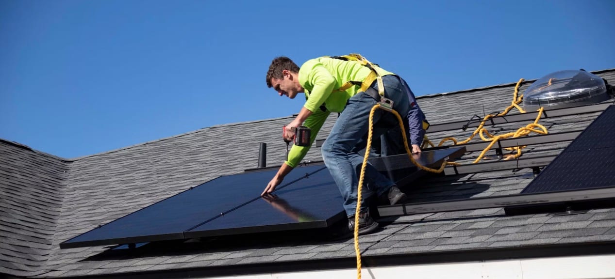
We write flood insurance coverage for many of our clients and can help you as well. TEXT or CALL us at 615.377.1212 or EMAIL us at info@BentonWhite.com. Since we are an independent agency, we have several companies we can choose from that best fits homeowners or other insurance needs. Please give us the opportunity to EARN your business!
Stay safe and HAPPY SPRING to you!
(Portions of this blog are taken from an article in THE TENNESSEAN written by Cassandra Stephenson who covers business at The Tennessean, part of the USA Today Network.)